CEI Recovers Sea Glider from Atlantic
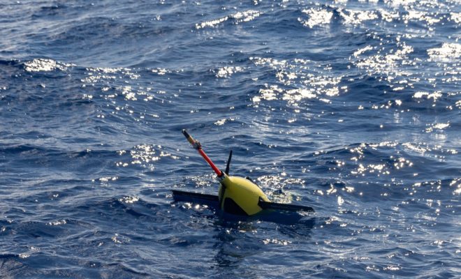
On November 12, 2021, research scientists from the Cape Eleuthera Institute (CEI) at The Island School recovered an underwater sea glider from the Atlantic Ocean. The sea glider is a torpedo-shaped autonomous drone that measures upper ocean characteristics, such as temperature and salinity levels. This data is to improve forecasting for tropical storms and hurricanes in the North Atlantic Ocean. Sea surface temperature and upper ocean heat content are fuel for hurricane intensity and development. Low levels of sea surface salinity also strengthen hurricanes. The glider dives down to 1000 metres to monitor the movement of different ocean masses that have unique temperatures and salinity levels as time goes by. The ultimate goal is to take measurements of the changes in the ocean masses and characteristics as tropical storms and hurricanes travel over the glider.
.jpg)
Dr. Nick Higgs (right) spots the sea glider in the water.
CEI deployed the glider off the east coast of Eleuthera during the most active period of hurricane season. For months, the glider took observational data travelling along the Atlantic Ocean while diving with instructions sent over satellite from the team in Miami. As the 2021 hurricane season came to a close, the team returned to the deployment site to recover the sea glider. The drone will be inspected for damage and repaired before scientists redeploy the glider for the 2022 hurricane season, which begins on June 1.
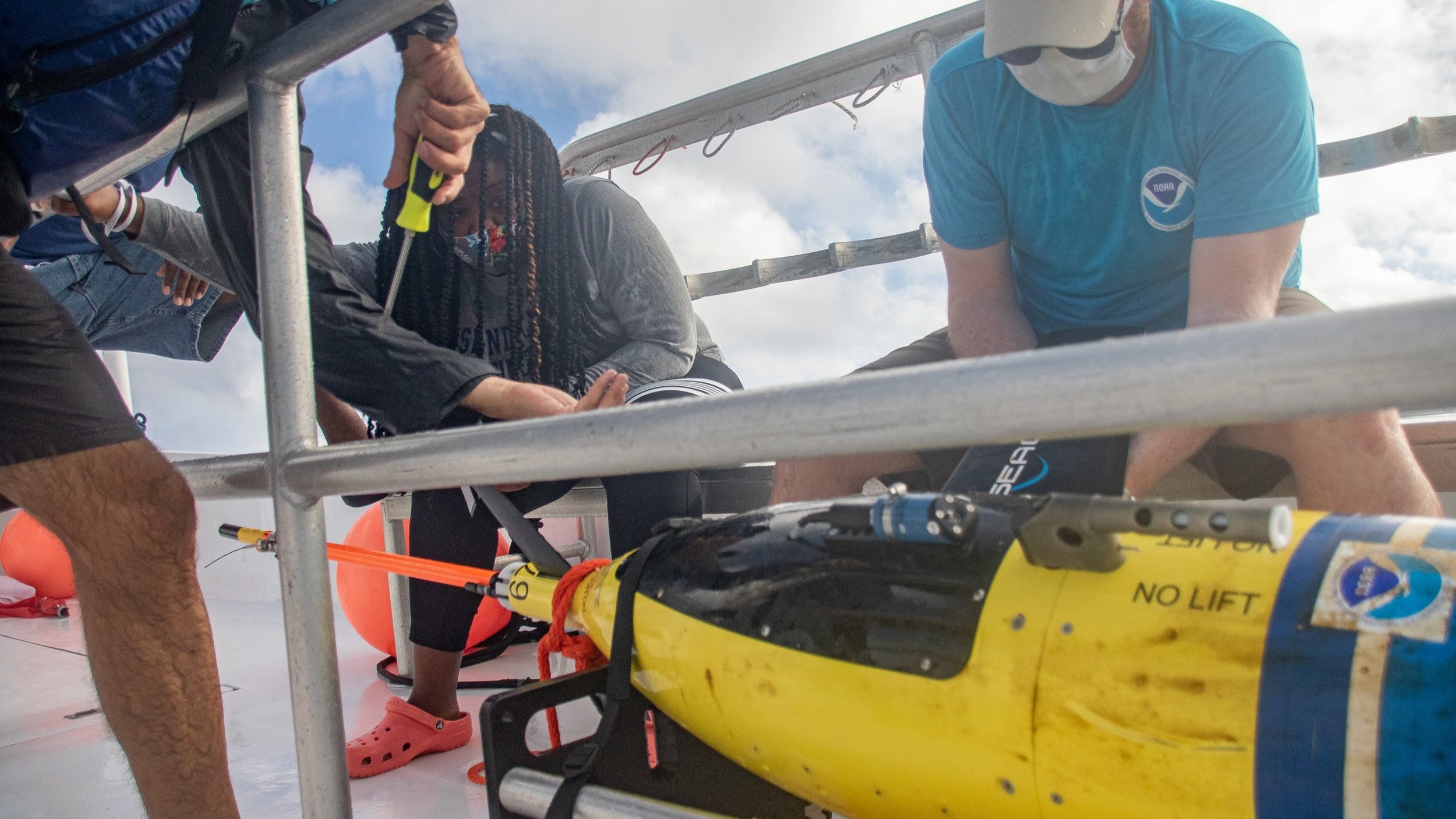
Scientists inspect the glider once it is recovered from the Atlantic.
The Cape Eleuthera Institute is one of the institutions throughout the Caribbean and North America collaborating with NOAA and the University of Miami on this enormous regional project. The glider deployment with CEI is the first in The Bahamas. This project is important because The Bahamas is one of the most hurricane-prone countries in the North Atlantic due to its location and proximity to Florida. This nation is one of the few to be historically affected by the four different hurricane types which develop in different areas in the North Atlantic basin. In addition to this, scientists at CEI view this partnership and research as a means to improve hurricane forecasting for The Bahamas and prepare our country with better warning systems.
.jpg)
As the global climate continues to warm, small island developing states like The Bahamas, are more susceptible to drastic changes in sea level and extreme weather events. With recent negotiations at COP26 to lower global warming to 2.4ºC (rather than 1.5ºC), we will experience more intense hurricanes, which show signs of quick intensification, similar to Hurricane Dorian in 2019. With this long-term project, CEI hopes to improve hurricane warnings for Bahamians and residents in the future.
By Marjahn Finlayson
Research Scientist